
LegendPeeps
Home Apps Weather Rivercast - River Levels App
Rivercast - River Levels App

Rivercast - River Levels App

4.61
|
V3.61
|
50K+
Rivercast - River Levels App screenshot Rivercast - River Levels App screenshot Rivercast - River Levels App screenshot Rivercast - River Levels App screenshot Rivercast - River Levels App screenshot Rivercast - River Levels App screenshot Rivercast - River Levels App screenshot Rivercast - River Levels App screenshot Rivercast - River Levels App screenshot Rivercast - River Levels App screenshot Rivercast - River Levels App screenshot Rivercast - River Levels App screenshot Rivercast - River Levels App screenshot Rivercast - River Levels App screenshot Rivercast - River Levels App screenshot Rivercast - River Levels App screenshot

App Information

Category Weather
Developer Juggernaut Technology, Inc.
Version 3.61
Content Rating Everyone
Price Free
Min Android 11
Updated Jun 11, 2026

Description

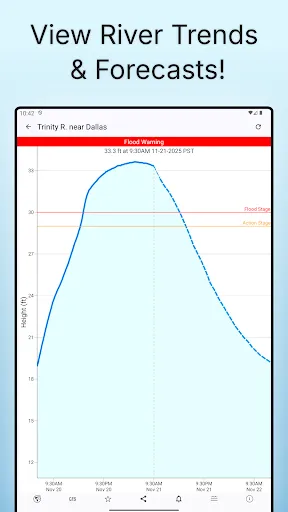
Rivercast™ puts the river level data you need at your fingertips with our intuitive and interactive maps and graphs.

Whether you’re a boater, paddler, property owner, or just curious about your local waterways, Rivercast makes it easy to see exactly what’s happening on the rivers that matter to you.

Rivercast includes:
• Over 12,000 active gauges across USA.
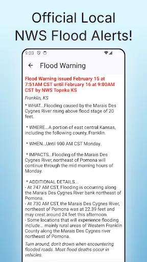
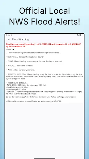
• Official flood warnings and alerts from the National Weather Service
• River stage height in feet
• River flow rate in CFS (when available)
• Color indicators showing when a river is normal, rising, or flooding
• Current observations and recent history
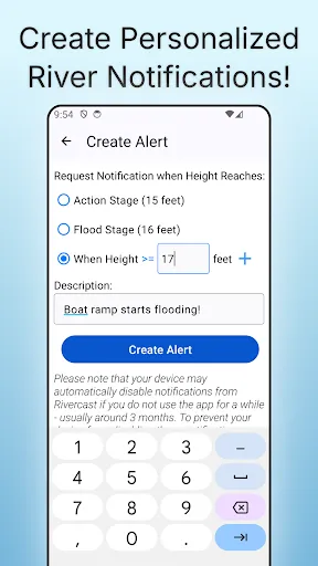
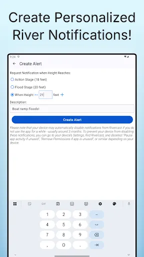
• Custom push notification alerts when a river reaches your chosen level (premium feature)
• NOAA river forecasts (when available)
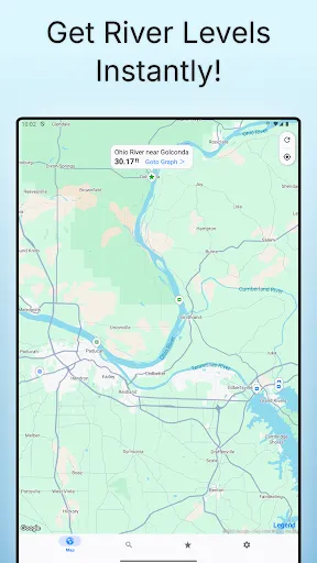
• Interactive map showing all nearby river gauges
• Search by waterway name, state, or NOAA 5-digit station ID
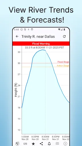
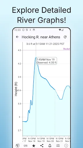
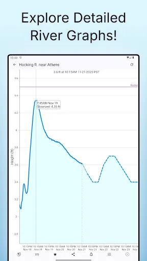
• Zoomable, pannable, interactive graphs
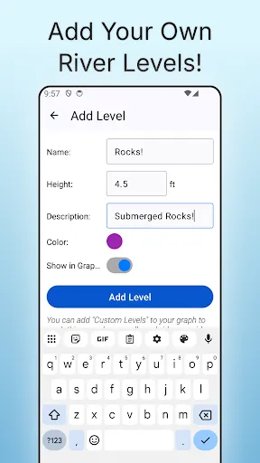
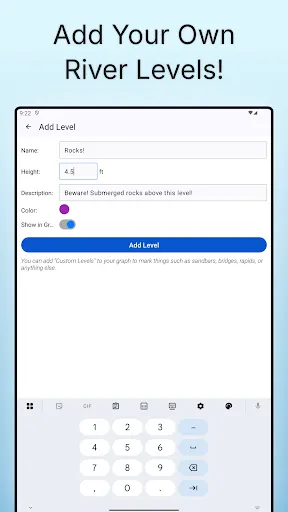
• Add your own reference lines for landmarks or safety levels
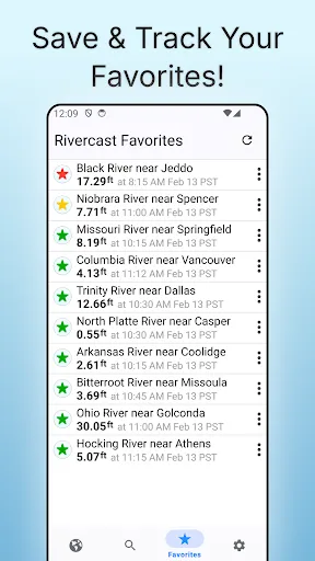
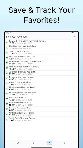
• Favorites list for quick access to your key locations
• Share your graphs via Text, Email, Facebook, etc.
• Dark Theme support
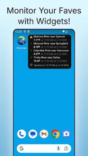
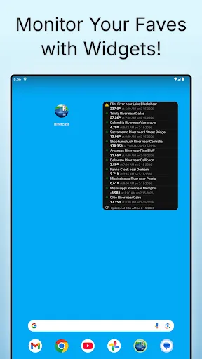
• Home Screen Widget to monitor your favorite locations at any time.

Rivercast’s map not only shows where gauges are located, but color-codes them to indicate whether each station is at normal levels, approaching flood stage, or above flood stage.

Tap any location to view the latest observations or open an interactive graph for detailed trends. Pinch or drag to zoom and pan, or tap and hold for precise readings using the crosshair tool.

Customize your hydrographs with personal level markers for bridges, sandbars, rocks, or safe navigation levels. Add favorite gauges for quick monitoring anytime.

Rivercast uses official NOAA observation and forecast data and requires an internet connection for data access. Data is displayed in feet or cubic feet per second (CFS) when available, always shown in your local time.

A trusted tool for boaters, fishermen, property owners, paddlers, scientists, and marine professionals who need clear, reliable river information.

The same trusted data helps you plan kayaking, fly fishing, and whitewater rafting trips and know when it's best to go.

River gauges reported are USA only.

We take our accuracy seriously!

* * * * * * * * * * * * * * * * * * * * * * *

Some Frequently Asked Questions:

Where does Rivercast get its data?
This app uses NOAA sources for its raw data for our custom graphing and mapping solutions. Some locations available only from other agencies (such as USGS) may not appear in this app.

Why does Rivercast sometimes show slightly different flow data (CFS) than USGS?
CFS is a calculated estimate derived from stage height. NOAA and USGS use different data models, so results can vary slightly—usually within a few percent. Stage height is always identical between NOAA and USGS, and designated flood stages are based on height in feet.

Why does Rivercast only show observations, but not forecasts, for my river?
NOAA provides forecasts for many, but not all, monitored rivers. Some forecasts are seasonal or only issued during high-water events.

My river gauge was there yesterday, but it’s gone today. Why?
River gauges occasionally have technical issues transmitting data or may even be washed out during flooding. Some are also seasonal. NOAA typically restores data within a few days or weeks.

Can you add location XYZ to your app?
We wish we could! If NOAA doesn’t report data for that location, we unfortunately can’t include it. Rivercast displays all stations that NOAA provides for public use.

Notice: Raw data used in this app is sourced from www.noaa.gov.
Disclaimer: Rivercast is not affiliated with or endorsed by NOAA, USGS, or any other government entity.

Downloads

V3.61

Size: 10.24 MB

Updated: 2026-06-11

User Reviews

4.61
639+ Reviews
5
75%
4
18%
3
3%
2
1%
1
3%
angus nebraska
Jun 26, 2026

have this app for 2 years. it is one of my most useful apps.

Gene Price
May 24, 2026

great app that is really helpful this app is very important to people in boating, fishing and wildlife fields that require levels and alerts

Ben Watson
Apr 26, 2026

Downloaded this for all of two minutes before uninstalling. Constant pressure to subscribe while simply adjusting the hydrograph, missing usgs gage stations on major waterways, it allowed me to set one favorite, and then told me I would need to subscribe to add any more. I guess it's cool if you always want to go to the same spot, and assuming that the correct gage will even show up. all this information is free from USGS, and since this interface is bloated adware, I'll just go look there

Amy Armstrong
Apr 21, 2026

I'm sorry but I think this app is way too confusing and I don't understand how to read it. call me stupid but that's my opinion. plus it tells me something different than the person who recommended this app to me. so now we are both a bit confused.

Chris Campbell
Apr 7, 2026

love this site. keeps me informed.

Scott Pauley
Mar 29, 2026

perfect 👍

Nicholas Lindborg
Dec 10, 2025

Awesome app

Brad Wesley (Double Deuce)
Oct 28, 2025

I use this app to check my local river fishing spot before I fish. I get the scoop on when the river is going to be rising. I love this app!!!

carolyn gamble
Sep 1, 2025

I love this app & Google turned it off WHY?

Mr. M.B.
Jul 16, 2025

Great App- Very accurate and extremely helpful for those near rivers or in flood zones! Some features are locked & require payment. In Florida there's regular flooding in some areas & information like this is vital. The app is overall functional and helpful without subscribing or paying. However, it should be available to all without restrictions or requirments of any kind- thats my only critique!